Tag Archives: Base Camp

Day 11-12: Namche Bazaar to Lukla

11/17-18/2015
Namche Bazaar 3446m/11270 ft.
Lukla: 2845m/9383 ft.
17km, 11.1 miles, 7-8 hours hike time

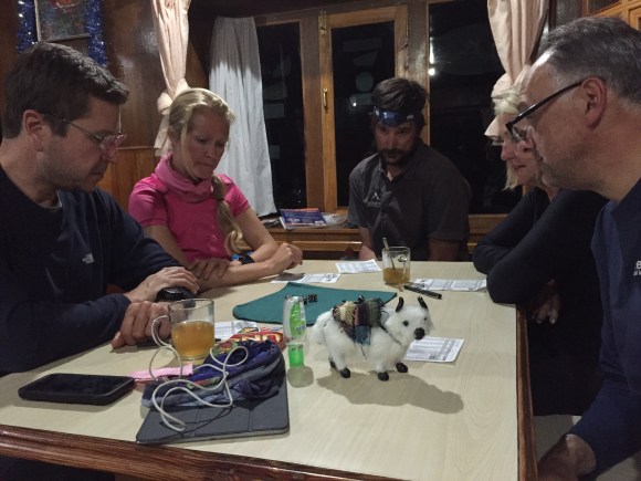
We spent a day relaxing in Namche Bazaar and trying to transition our minds to reconnecting with reality. Namche has a measurably better wifi connection than other stops along this route so we all updated friends and family, sent photos, and shared them with one another. We also kind of quietly retreated into groups of two or three, picking cafes or bars for lunch or a drink rather than congregating in the communal dining room at our teahouse. There is definitely a sense that the worst is over. Where once the team was our focus, now exploring the local experience is more prevalent on our minds.

I was still tired but felt better after a solid night’s sleep. I went out to stock up on the local cold meds, using my pantomime skills to explain to the Nepali woman that I needed relief for a cough and (now) head congestion. I wandered the streets for a bit, enjoying the warm sunshine and odd sites you only find in towns like this. I found an ATM and marveled that 400 rupees will tide me over for a long time here in Nepal and only cost me about $40USD.

Farming outside Namche

Continue reading

Advertisement
Tagged , , , , , ,

Day 8: Base Camp

After a quick stop for tea at Gorak Shep a few of us hurried on in the late afternoon. And here we are at our first goal, 17,600 feet, the site of the Base Camp for Mt. Everest expeditions! (And yet this was not the most exciting day, stay tuned for tomorrow.)

I’d forgotten that the weather window to summit Everest comes in the spring so was surprised to find the area deserted. A pile of stones strung with prayer flags marked the unofficial entrance, overlooking the Khumbu glacier and icefall, and the rocky valley floor where camp is built. After brief disappointment, the isolation and history of the area turned the moment magical.

Base Camp is set up in the flat area circled in black in the center of this photo. The Khumbu Icefall, which is the first step up to Everest, follows the red line, and the Khumbu glacier follows the green line on the right. Continue reading

Tagged , , , , ,

Day 8: Lobuche to Gorak Shep to Base Camp

11/14/2015
Lobuche: 4930m/16175 ft.
Gorak Shep 5164m/16942 ft.
Base Camp 5360m/17650 ft.
6-8km, 4-6 miles, 7 hours hike time

Terrain: A steady sloping up on a rocky trail that alternates between valleys and hillsides.

A fun surprise for us at Lobuche as we reconnected with two team members who’d split off at Namche wanting to move faster and skip Base Camp on their way to climb Lobuche peak. It was fun to catch up and hear that they’d made their goal and were safe and sound.

The teahouse was the most crowded yet, not unlike a Colorado ski lodge during spring break. I noted the ratio of women to men, probably in the range of 4 to 1, and most people looked like serious climbers. I suspect this must be a launch point for expeditions to many of the nearby peaks. Continue reading

Tagged , , , , , , , ,

Day 7: Dingboche to Lobuche & The Valley of Ghosts

11/13/2015
Dingboche: 3867m/12687 ft.
Lobuche: 4930m/16175 ft.
8km, 5 miles, 5.5 hours hike time

Terrain: Rolling hills climbing above the treeline. Surrounded now by the big peaks.

In 1996 journalist Jon Krakauer signed on with an expedition to climb Mt. Everest. He was, and is, both a climbing fanatic and a writer, on assignment for Outside magazine to research the recent boom in climbing outfitters taking people up the mountain.

The story of the blizzard that engulfed the summit, trapping several climbing parties and killing 8 people, is well-known. Until the 2014 avalanche, it was the largest loss-of-life in a single day on the mountain. The very commercialization Krakauer was there to research is blamed for a large part in the tragedy.

Continue reading

Tagged , , , , , , , ,

Day 6: Rest day in Dingboche

11/12/2015
Dingboche: 4410m/14468 ft.

Well, I made it one more day. That’s about all I remember after we said goodbye to four members of our team and continued up the hill. When we arrived at Dingboche I went straight to bed and stayed there for a solid day, making trips to the bathroom to dry heave. Ryan gave me permission to skip the acclimatization hike on the morning of our rest day.

The teahouse was lively and seemed full of fun, and I heard Dingboche had a coffee and pastry shop that I was sad to miss.  I didn’t feel like socializing, but our room had ice coating the inside of the window and the warmest place was the dining room, so I took short forays out to drink Sprite and nibble on bread. A group of 5-7 English men sitting at the nearby tables struck up a conversation the first night. They were drinking pretty heavily which amazed me seeing how badly that goes with altitude and exertion.  Our group stuck to tame entertainment like Yahtzee and cider. That’s Ellie the yak watching over the game.

Serious Yahtzee going on (seriously posed that is)

Continue reading

Tagged , , , , ,

Day 5: Deboche to Dingboche

11/11/2015
Deboche: 3867m/12687 ft.
Dingboche: 4410m/14468 ft.
9km, 5.5 miles, 6.5 hours hike time

Terrain: Much of the trail follows along the side of the mountains offering gorgeous views of mountains and valleys. Flat, with a gradual upward slope. The crowds thinned out a bit.

It was a quick night at Deboche and I was restless and ill. Up and down between bed and meals, cold in the room but hot in the dining area, back and forth to the bathroom, which was not a pleasant place to be sick.

The next morning four members of our team turned around to head back down the hill. The full trip was long – 21 days – and some people couldn’t take that much time away. We’d started the trip with 21 people and now we were down to 11. Both Jagat and Tricia (TFK’s Ops Director) were leaving, along with two fun-loving guys we’d enjoyed. This made the group a bit more intimidating since there were now only two others who weren’t fairly serious climbers. Continue reading

Tagged , , , , , , , ,

Day 4-5: Namche to Deboche

11/10/2015
Namche Bazaar: 3446m/11270 ft.
Deboche: 3867m/12687 ft.
6.5km, 4 miles, 6.5 hours hike time

Terrain: Gorgeous views from high on a mountain side, climbing steadily then sharply up to Tengboche Monastery on a rough trail. Trail continues down to Deboche.

We spent two nights and roughly a day-and-a-half in Namche Bazaar. It’s the first village that lies above the threshold where altitude sickness might begin so most teams spend a day there to aclimatize. On our rest day we did a short hike above the village to a clearing that provides the first view of Mt. Everest.

Tenzing Norgay stands forever in front of Mt. Everest on the back left, with its ever present banner cloud.

A nearby national park visitor center provides a fascinating overview of the Khumbu region, and at the base of the hill is the beloved Sherpa museum. This is a must see, filled with artifacts of Sherpa life historic and modern, as well as an extensive gallery of photos and equipment from famous climbers and expeditions. Continue reading

Tagged , , , , , ,

Day 2-3: Tok Tok to Namche Bazaar

11/8-9/2015
TokTok: 2544m/8700 ft.
Namche Bazaar: 3446m/11270 Ft.
7km, 4.5 miles, 6.5 hours hike time

Terrain: Gently rolling trail until after lunch, then a steep climb up a long hill using stairs and switchbacks for 2-2.5 hours.

As we struck out from Lukla that first day we quickly encountered something Ryan had mentioned during the pre-briefing: Mani stones. All throughout the Himalaya are symbols of the Buddhist faith that is an important part of their life. Chortons are one example; they are usually larger, constructed structures that look like religious structure and often contain prayer wheels. Mani stones are rustic shrines; large rocks painted or carved with prayer symbols, or piles of rock slates on which the symbols are cut and painted.

Prayer wheels are supposed to be spun clockwise, the direction of the earth’s revolution, according to Buddhist tradition and mani stones are approached the same way and passed on the left side. Ryan had warned us that other trekkers and locals will call you out if you break the custom, which is sometimes tempting when the easier path is a downhill slope to the right.

This was our first mani wall. You can’t see in this shot but there is a path around both sides of the wall. People approaching from the opposite direction would pass the wall on the path that is to my right. We went left.

Continue reading

Tagged , , , , , ,

Day 1: Lukla to Tok Tok

11/7/2015
Lukla: 2860m/9350 ft.
TokTok: 2600m/8700 ft
9.7km, 6.2 miles, 5hours hike time

Terrain: The trail rolls up and down on a gentle overall decline. A good first day to stretch your legs and work out the kinks. Lots of stairs. Quite crowded with people and animals.

After a quick day and night back in Kathmandu to organize and purchase any last minute items (Thanks to my inability to bargain I now own a pair of outrageously priced trekking poles) we took the 40-minute flight from Kathmandu to Lukla this morning to start our adventure!

The street and shops near our hotel in Kathmandu

The street and shops near our hotel in Kathmandu

Back in Kathmandu we also switched into “expedition mode” with a planning session from our American guide Ryan Waters. Ryan is a record-setting explorer who’s climbed a zillion mountains and been up Everest four times, summiting three. He was the first American to complete the Adventurers Grand Slam, reaching both poles and all seven summits. He owns Mountain Professionals guide company based in Boulder, and is an all around world-class guy. He’s probably also exhausted, since he came straight here from guiding a team up Carstenez Pyramid in Indonesia, but he’s so laid back you’d never be able to tell. Continue reading

Tagged , , , , , , , , ,